Backpacking the Adirondacks in April
Early Spring can mean a variety of conditions in the mountains, and I got to experience exactly that when I went on an overnight backpacking trip last weekend. In just 18 miles round-trip I summitted four 4,000-footers and experienced steep scrambles, roaring waterfalls, deep snow, hot sun, and cold rain.
I started Friday morning at the Adirondack Mountain Reserve's hiker parking lot at St. Huberts. Despite their name, the AMR is a private club that owns a swath of land around Upper and Lower Ausable Lakes. The NY DEC has an easement with them to allow hikers to access the high peaks through the private property, but you have to abide by the AMR's rules and no camping or off-trail travel is allowed.
The St. Huberts parking area provides access to many scenic locations through the AMR property, and apparently it gets so busy in the summer that reservations are required. When I arrived at 8:30 on Friday morning it was about one third full. I parked and started on the 1.5 mile road walk to the start of the trail proper.
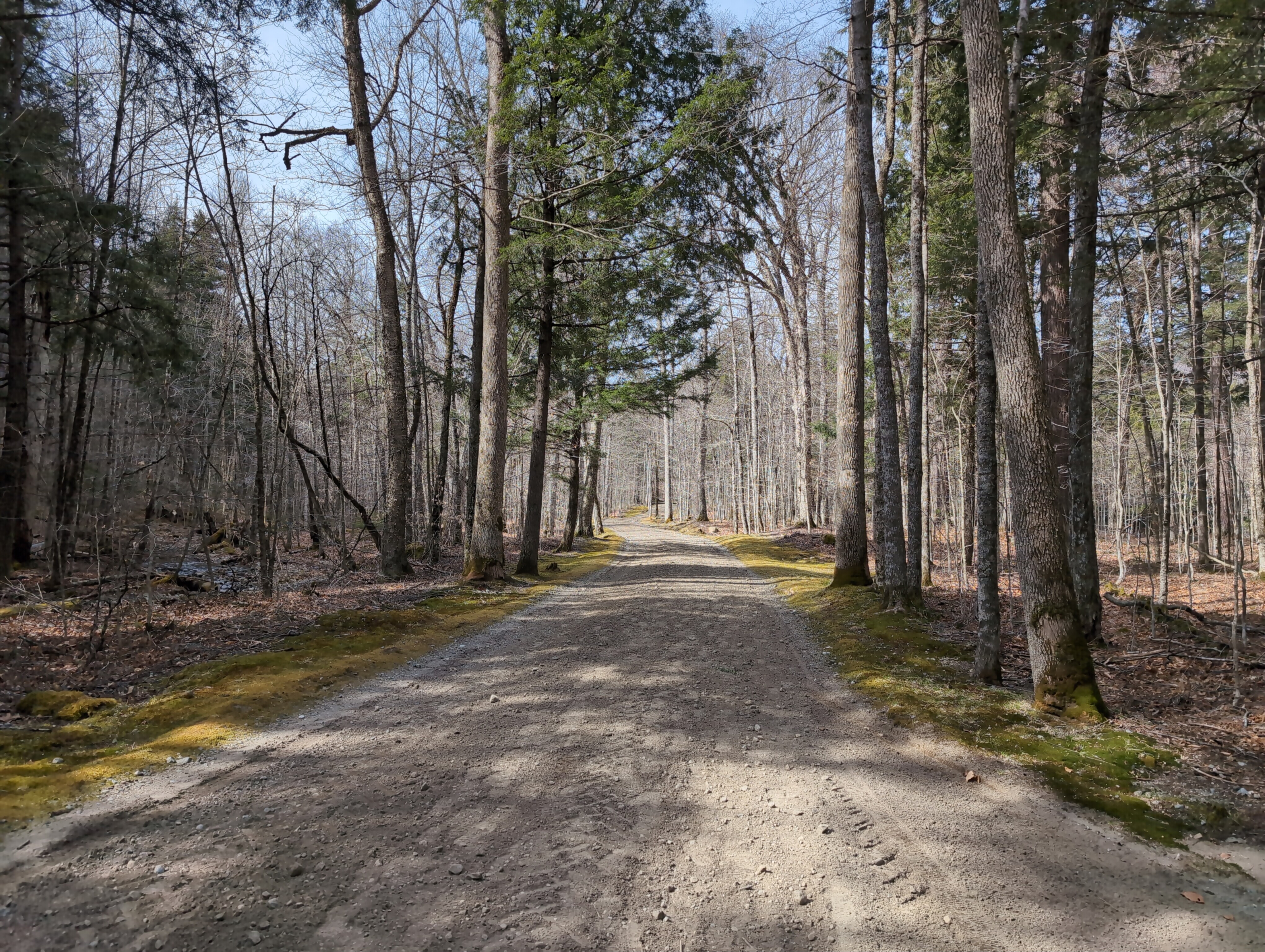
This was a nice start, as road walks go. It was a sunny 50 degrees, and the dirt road winds past streams and boulders through some very scenic woods. I took the H.G. Leach Trail to the left and began the steady ascent to Bear Den Mountain.
Around 2500 feet in elevation I passed the private property boundary onto public DEC land, the High Peaks Wilderness area. Pretty soon I started encountering patches of lingering snow and ice, but it was still hot and sunny out so I was sweating.
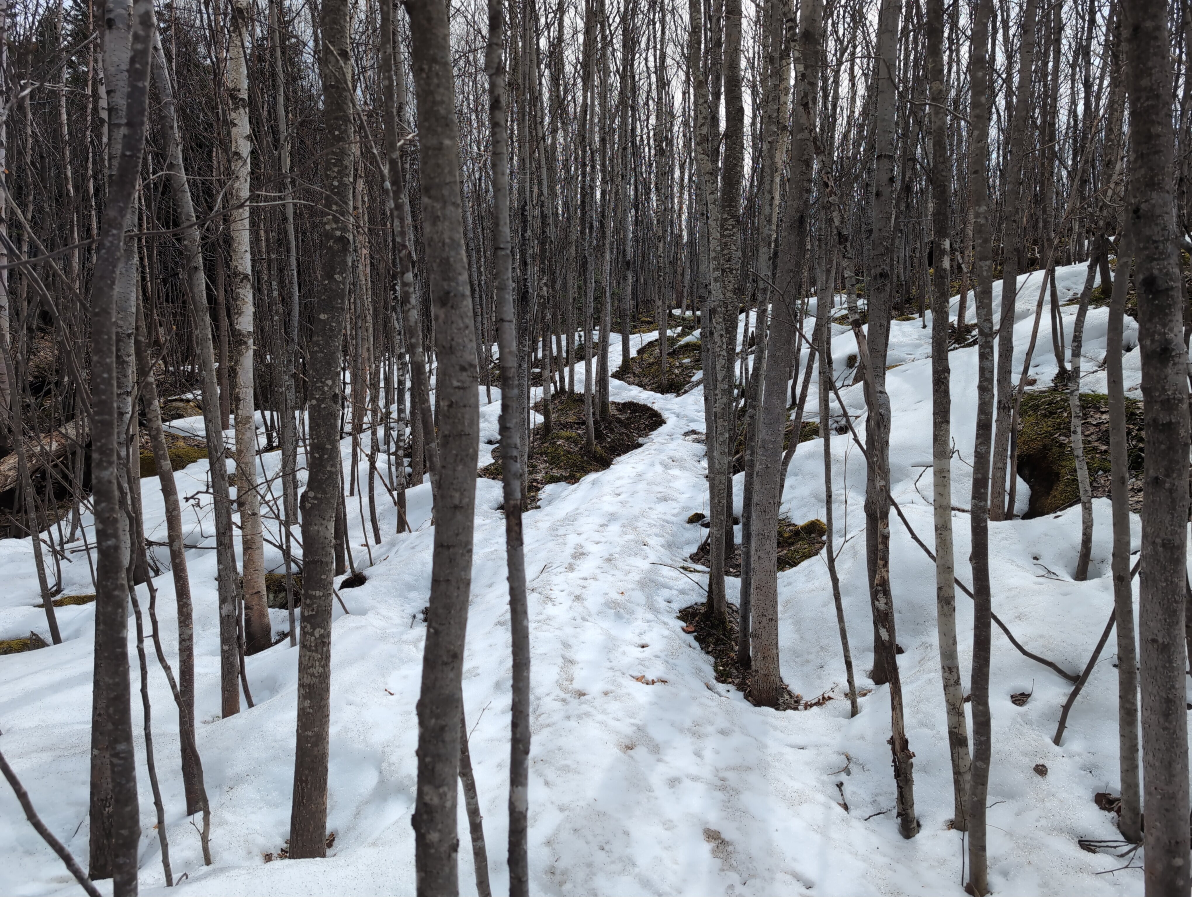
The summit of Bear Den Mountain apparently suffered a wildfire sometime in the recent past, judging from the remaining burn debris and dense new growth trees. As the snow became deeper and more consistent I put on my microspikes to keep from slipping.
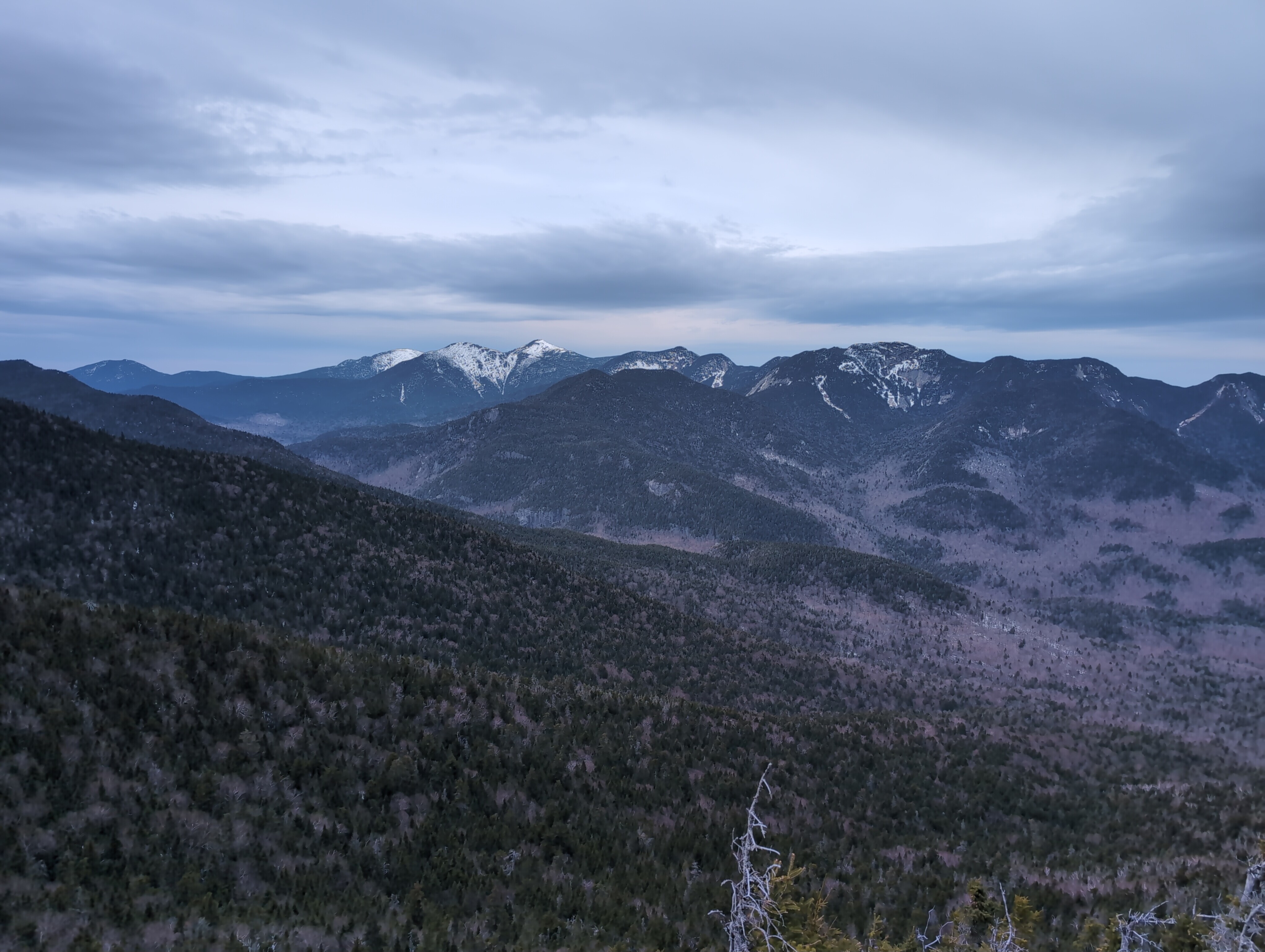
Some open ledges near the summit of Bear Den provided excellent views of the Great Range and approaching clouds. After a brief descent I continued climbing toward the first 4,000-footer of the trip, Dial Mountain.
I met a couple of other hikers coming down from Dial, who warned me the trail along the ridge from Dial to Nippletop was overgrown and difficult to follow, but at least I'd be able to stick to their footprints. I soon reached the outlook at the summit of Dial and stopped for a quick snack, then continued toward the higher Nippletop.
The trail was indeed very overgrown and hard to follow, even with a set of footprints ahead of me. I was constantly pushing through spruce branches, stepping around fallen trees, and struggling to find trail markers. This made for very slow progress, but eventually I reached the intersection with Elk Pass Trail, which I would be taking down to the pass where I planned to camp. But first it was just .2 miles of sketchy up and down, edging along snow ledges to the summit of Nippletop, my 13th Adirondack 4,000-footer.
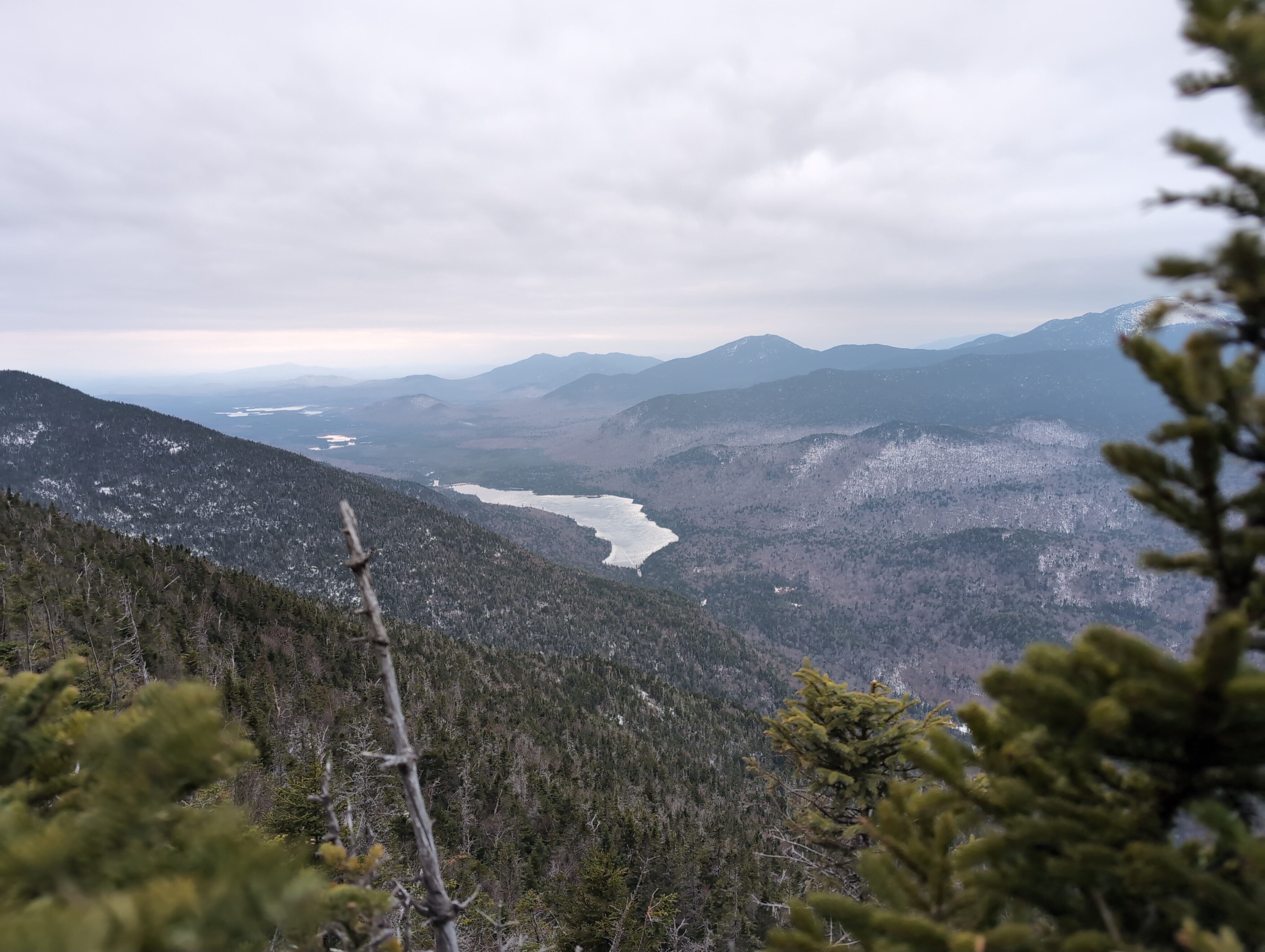
I was met by great views of the dramatic avalanche slides on Dix Mountain, as well as another view of Mount Marcy and the Great Range. It started lightly raining as I returned to the intersection, so I put on my rain pants and jacket to prepare for the steep descent to Elk Pass.
This trail was extremely steep, even by Adirnodack standards, descending over 1,000 feet in just 0.6 miles. With the thick coating of ice and intensifying rain I ended up slipping and sliding down a lot of it. Eventually I made it to the bottom, and found a designated campsite by a small pond.
I was happy to have a freestanding tent, as it would have been difficult trying to anchor anything in the melting snow. Fortunately the rain had paused, so I quickly set up camp, refilled my water bottles at the stream, and cooked some dinner.
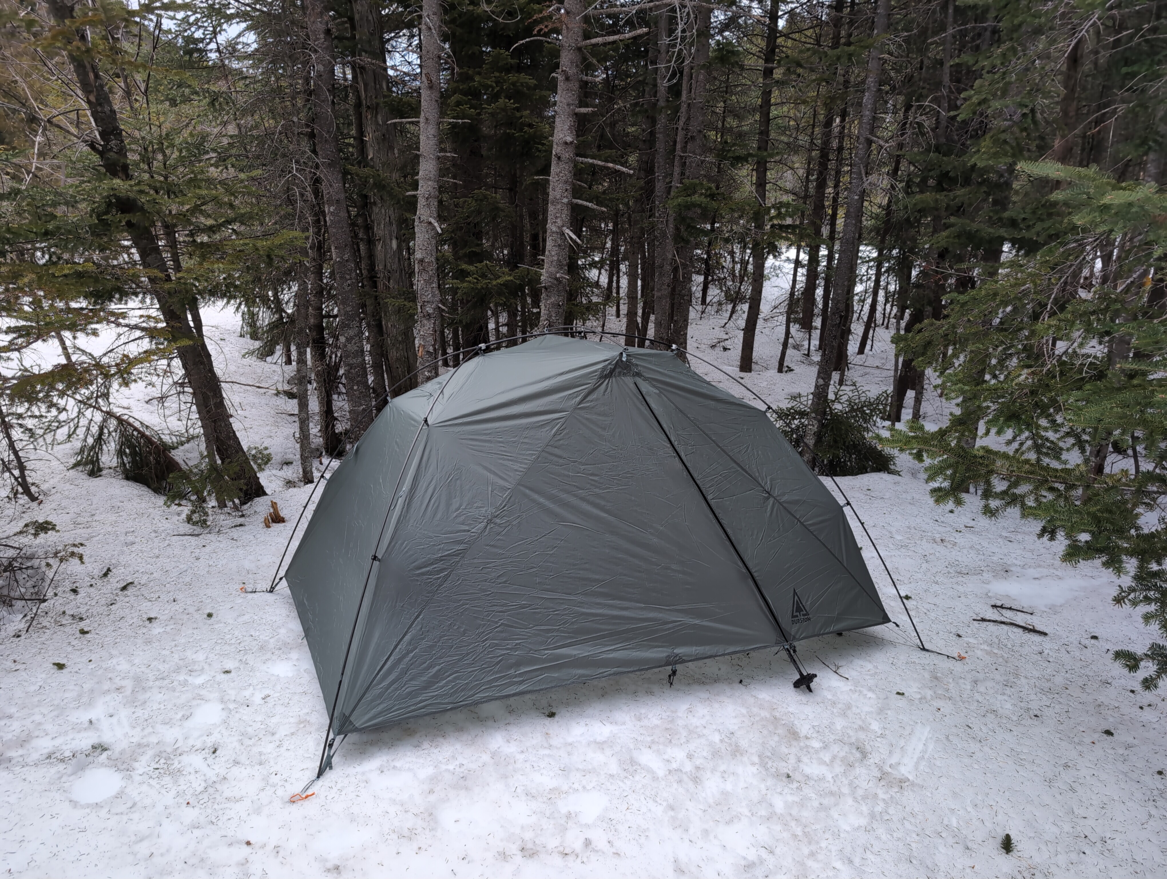
I crawled into my quilt as the sun was setting around 8:00 PM, just as it started raining again. I didn't end up getting much sleep. The sound of rain and wind kept waking me up, and my pillow had apparently developed a small hole because it would not stay inflated for more than a few minutes. I kept waking up with a sore neck every time there was a strong gust of wind. I definitely still prefer hammocks for camping, I always get a better sleep in them. My thermometer recorded an overnight low of 36 degrees, and I was happy to just get out of there when the sun finally rose in the morning.
I was slightly delayed in packing up as I couldn't find where I had stashed my bear canister the night before, but I eventually retraced my steps and found it.
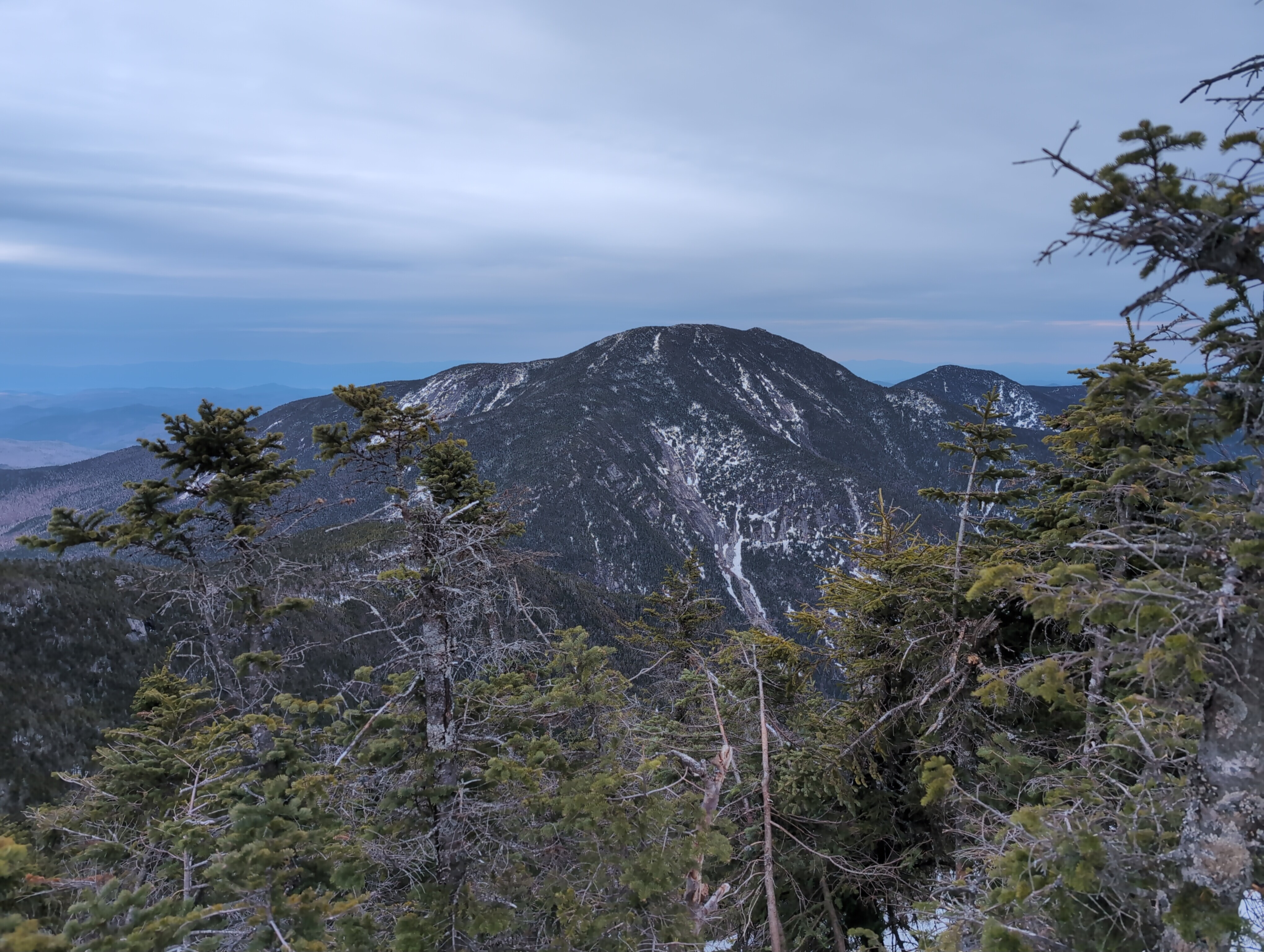
I quickly made it to the intersection with Colvin Trail, which I would be taking for a 5 mile round trip out-and-back to bag two more 4,000-footers. The trail starts with a relentless 800-foot climb up to the top Mount Colvin, where I got some nice views of the Ausable Lakes.
From the summit of Colvin, the next leg of the trip appeared pretty disheartening. I had to steeply descend roughly 500 feet to the col between Colvin and Blake Peak, then immediately climb 500 feet back up to Blake's summit. Then the only way back is to do the same thing again in reverse, all the way back up to Colvin. All for a peak without any views, which is only 3,960 feet high (Blake is included in the list because earlier surveys put it at the necessary 4,000 feet).
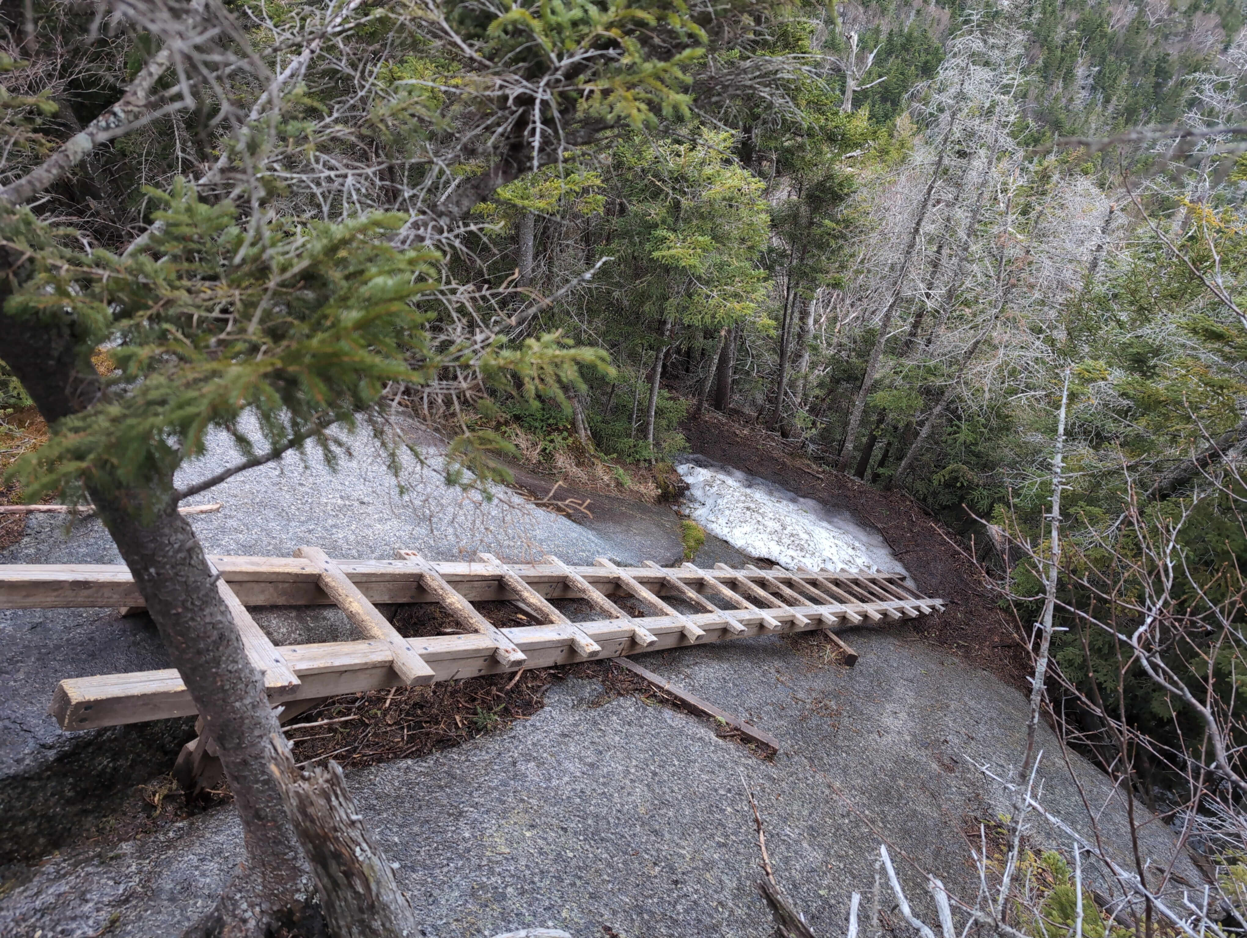
I slowly and carefully climbed down from Colvin as it started raining harder. I had to lower myself down some rock ledges and over a couple of wooden ladders.
The bottom of the col was enveloped in fog and I almost got turned around and lost the trail a few times. The climb up Blake Peak was not as steep, but still grueling and with no view as a reward on the wooded summit. I ate a protein bar and turned around.
The steep ascent back up to Colvin was rough, and I took it very slow. When I got back to the summit it was fully socked in by clouds and pouring rain. By the time I got back to the intersection with Elk Pass Trail it had been a full five hours for a 5 mile out-and-back.
I was pretty exhausted, but I had accomplished my goal of bagging four more 4,000-foot peaks in the Adirondacks. I proceeded down Gill Brook Trail back towards the road, but decided at the last minute to take a small detour to Indian Head via the Fish Hawk Cliffs Trail.
And I was glad I did, the cliffs overlooking Lower Ausable Lake had by far the best view of the whole trip.
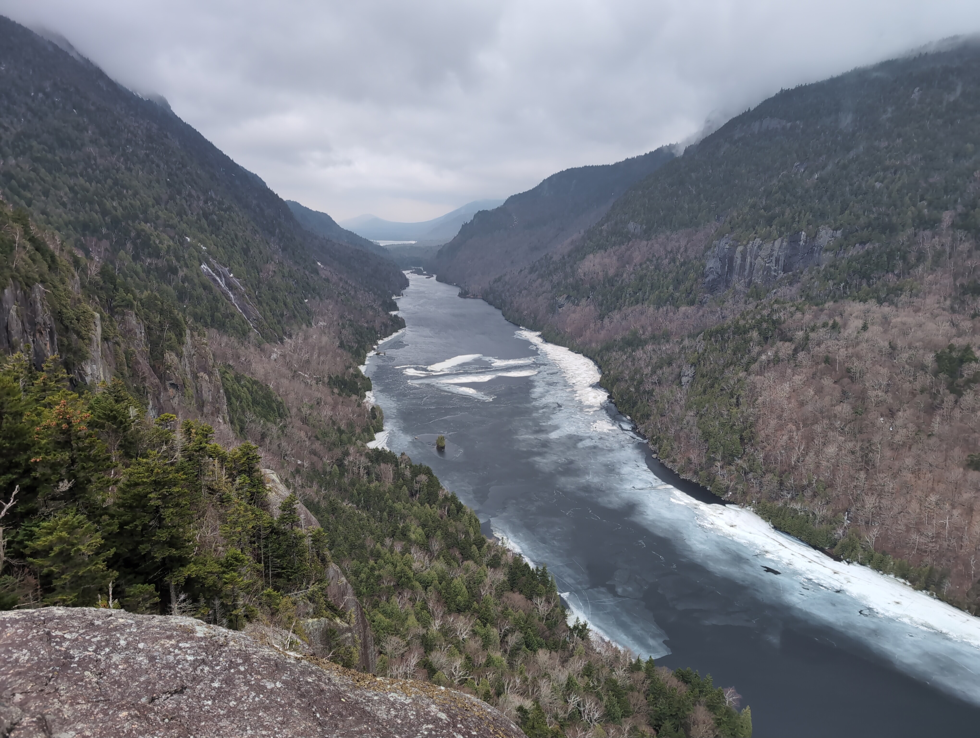
I sat on the cliff for a long time despite the off-and-on rain, just taking in the view. Eventually I had to move on, climbing over the top of Indian Head and connecting back to Gill Brook Trail.
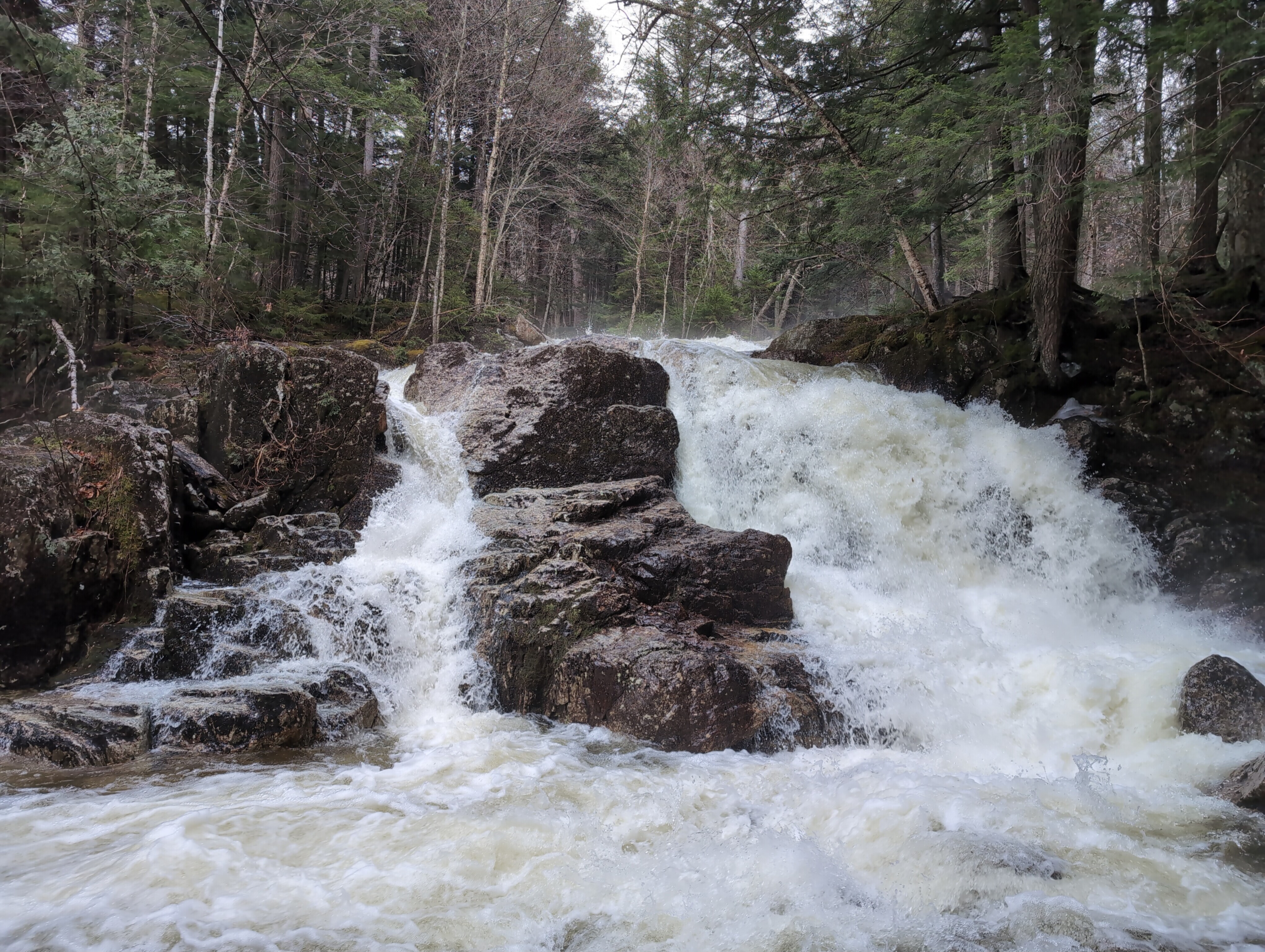
Indian Head was very picturesque, but Gill Brook was surprisingly scenic too. The water level was high from all the snow melt, and there were several spectacular waterfalls as the trail followed it back down to the road.
Ice finally became sparse enough around 2,000 feet that I could take off my microspikes, and follow the gentle descent back to the road. This section was a great way to end the trip, and it was warm enough I didn't mind the light rain.
Gill Brook Trail eventually connected back to Lake Road, and I took the 2.5 mile road walk back to the parking area, finishing right around 6:00 PM on Saturday. Overall it was a great trip, spanning 18 miles and 5,700 feet of elevation for four 4,000-footers and lots of unique views and different trail conditions.
Early Spring can be a difficult time for hiking, with unpredictable weather and variable conditions, but it can also lead to some incredible experiences if you're prepared.