Backpacking the southern Presidentials
This past weekend I took a day off work to get in some solo backpacking in New Hampshire's Presidential Range. It ended up being the most scenic, and the most strenuous hiking trip I've ever done.
Day 1
I woke up early on Friday morning and drove up to the starting point of my trip, the AMC Highland Center in Crawford Notch. This is a major tourist spot and the start of several great trails, so the parking lots were already starting to fill up by 7:30 on a Friday morning. I did a final check of my backpack, put on my hiking shoes, and started up the Crawford Path.

First cleared in 1819, this is supposedly the oldest continuously-used hiking trail in America. It follows the spine of southern Presidential Range from Crawford Notch to the summit of Mount Washington, the tallest mountain in the northeast. The scenery at the start is typical New Hampshire forest, and the trail is wide and well maintained. The gradual uphill pace seemed to fly by, and before I knew it I was at the Mizpah cutoff junction, and then at the Mizpah Spring Hut itself.
I topped up on water at the hut and pushed on up the short but steep ascent to the summit of Mount Pierce, the first 4,000-footer of the day. At 4,300 feet the summit of Pierce isn't above the treeline yet, but it's close. The trail crosses over open rock slabs surrounded by krummholz, diminutive pine trees twisted by the constant wind. The summit was still shrouded in the morning cloud cover, so there were no views to be had here. But I had just completed my 27th 4,000-footer and was feeling good. I got back on the Crawford Path and continued on.
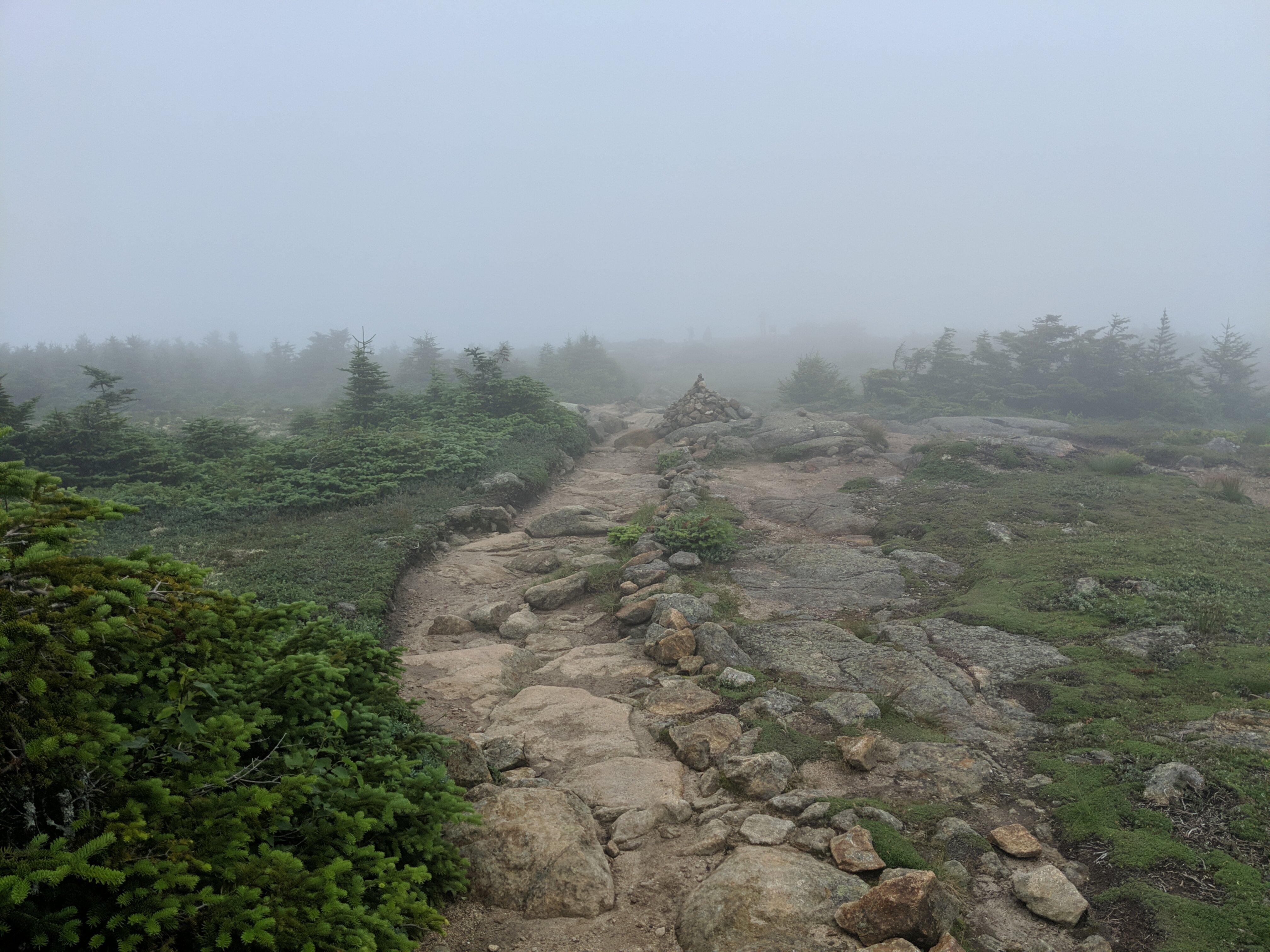
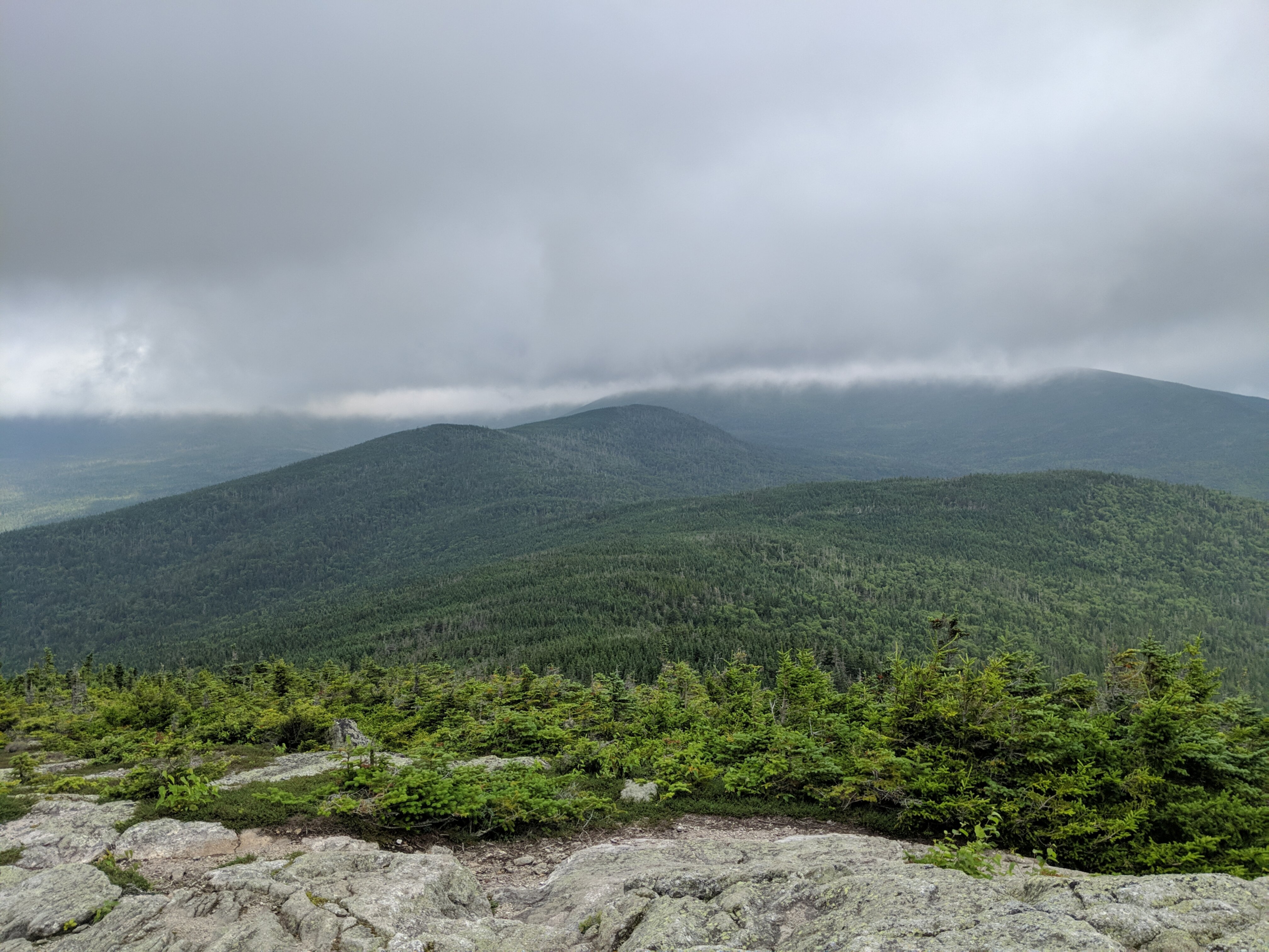
The trail dipped back into taller trees as it wound along the ridgeline toward Mount Eisenhower. The official Crawford Path actually skirts around all the peaks on this trip, but each time there's a short loop that bags the summit and then reconnects to the main path. Just as I turned onto the Eisenhower summit loop the sun started to peak out and the clouds started to lift, granting a view of the Mount Washington Hotel thousands of feet below. The weather finally cleared enough to get an excellent view of the trail ahead just as I crested the top of the Eisenhower dome.
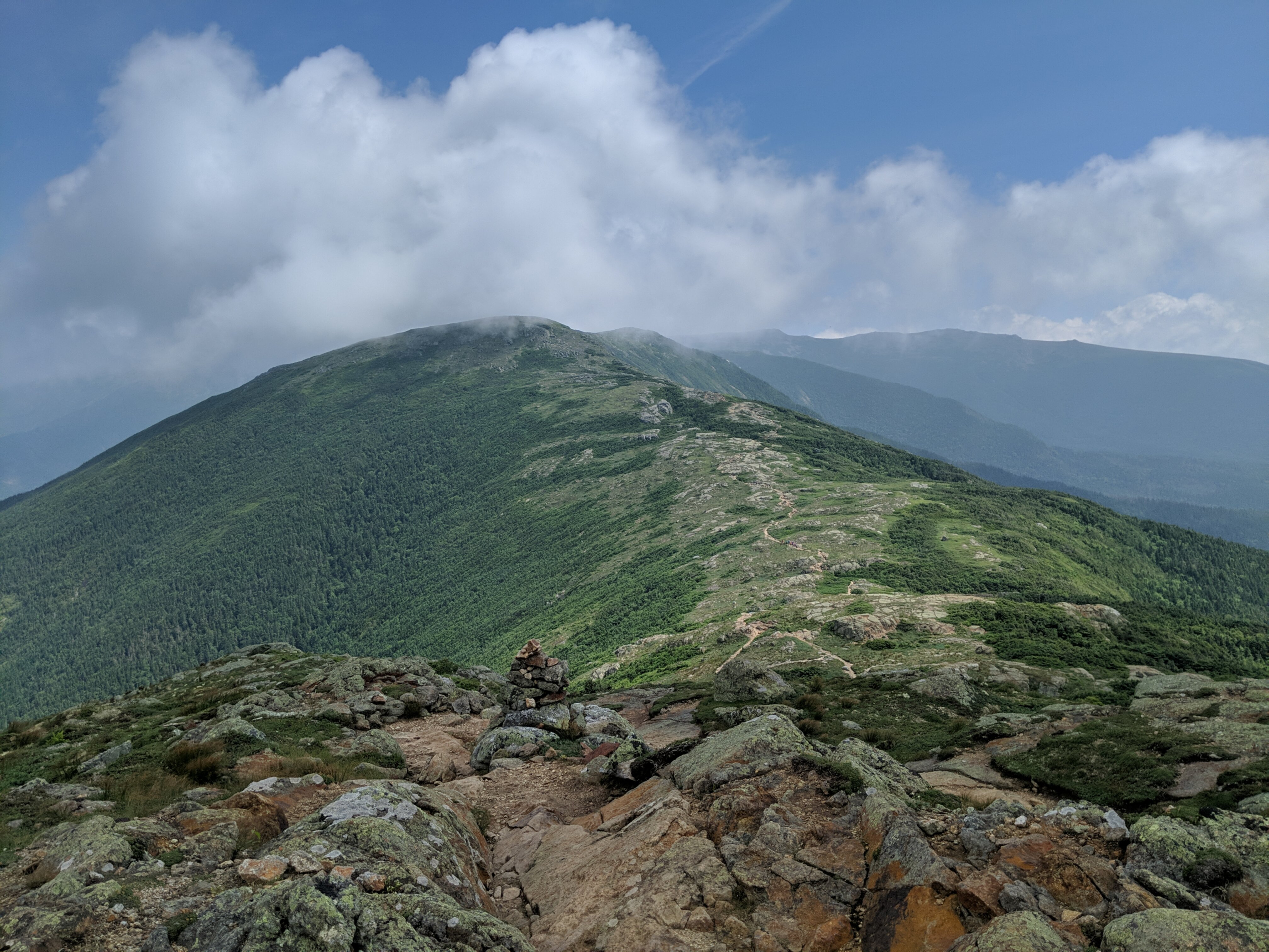
Hiking above the treeline is truly a special experience, and there aren't many places where it's possible in the northeastern US. On a clear sunny day like I had you're constantly surrounded by awe-inspiring 360 degree views. When you constantly have something stunning to look at, even hiking up steep boulder fields doesn't feel tiring. I quickly made it to Mount Franklin, over 5,000 feet tall but not prominent enough above the ridgeline to count for peak bagging.
I realized I had been walking non-stop for the past 4 hours, covering 6 miles and 3,500 feet of elevation gain. I sat down on a rock to eat a protein bar and enjoy the view. It was now almost noon and the weather was perfect: low 60s with scattered clouds above and a slight breeze.
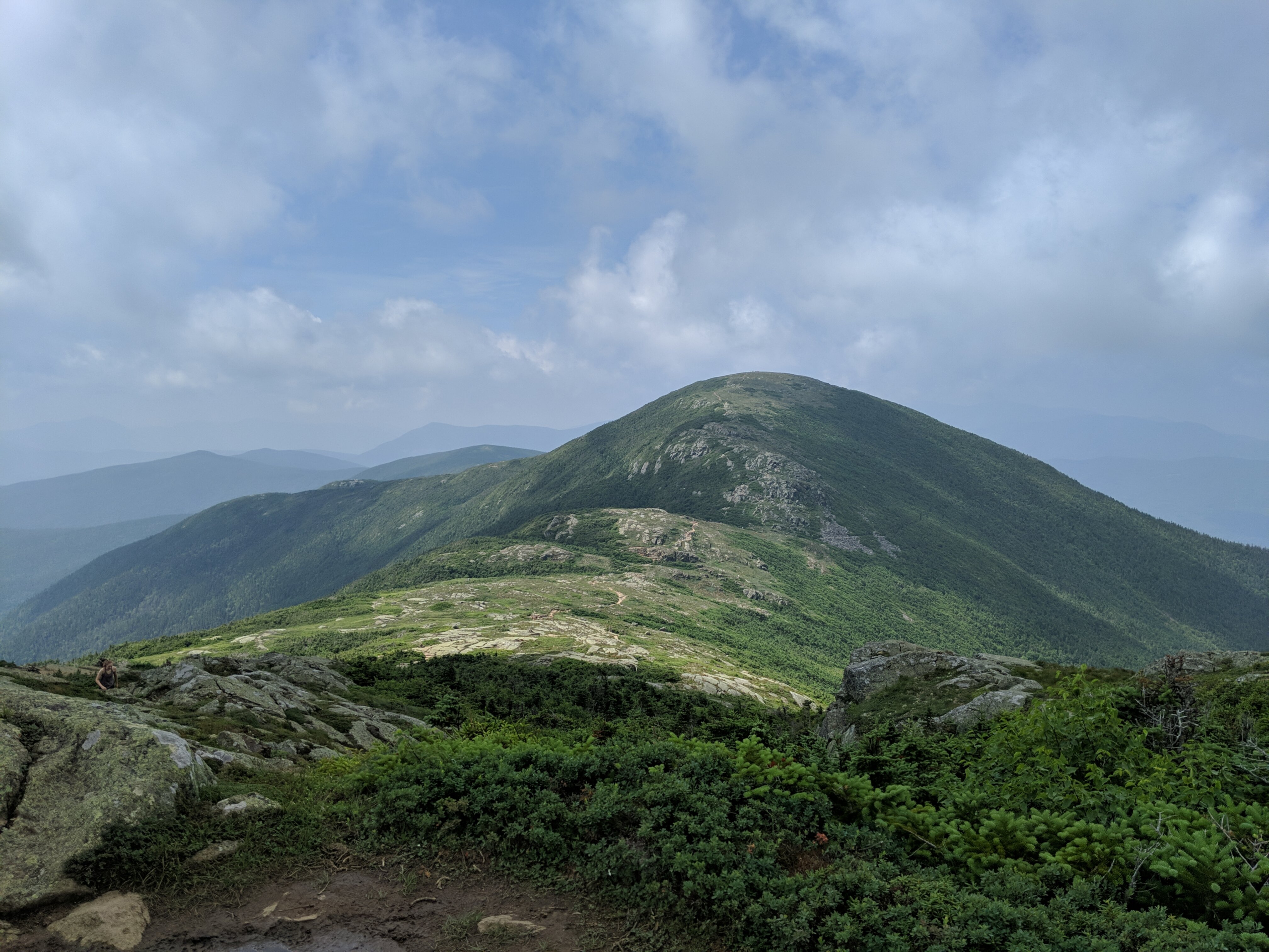
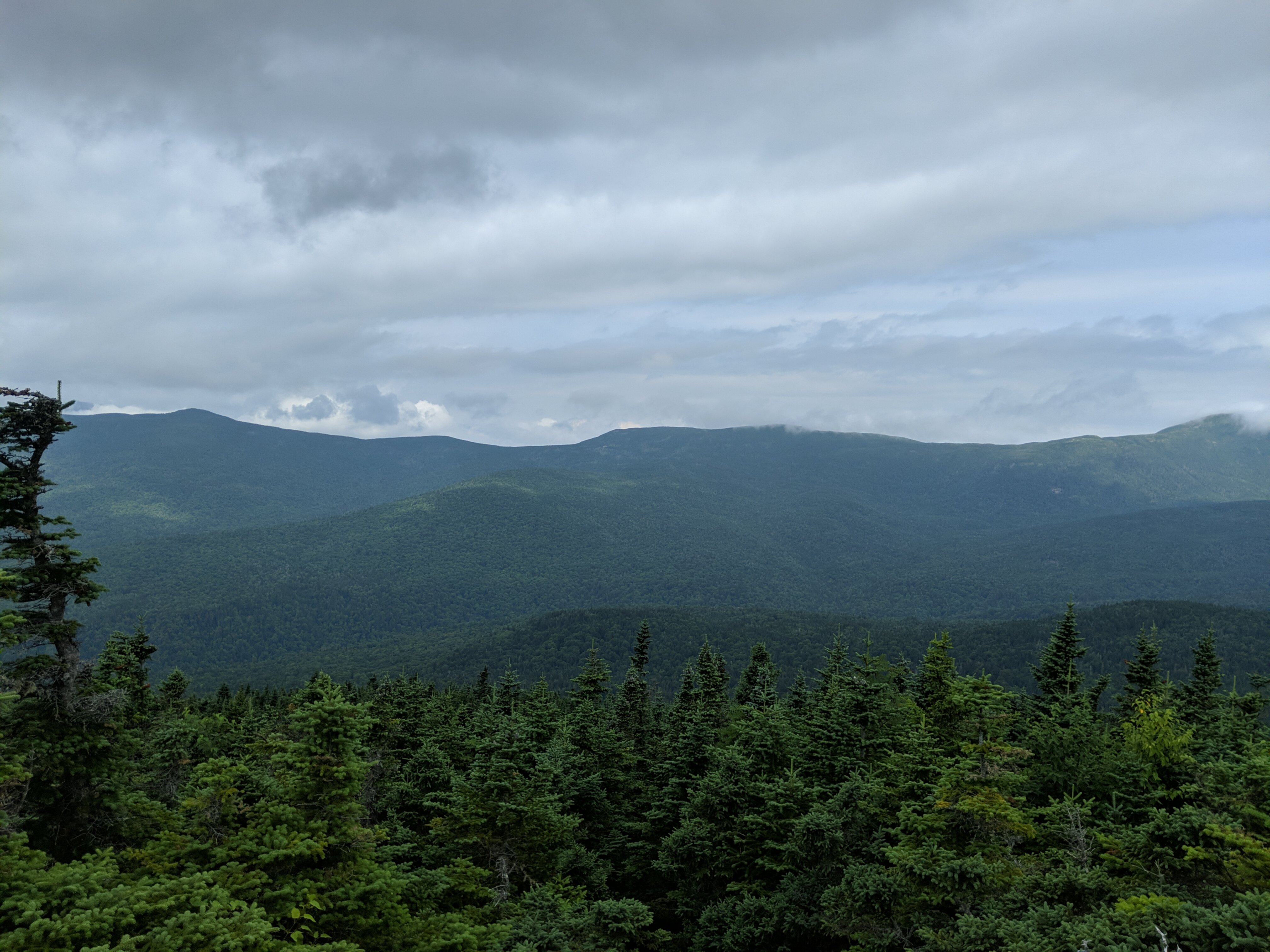
I had already climbed a significant distance, but I was making good time and felt good so I continued on after just a few minutes. My next target was Mount Monroe, and its knobby sub-peak Little Monroe. The trail up Little Monroe was a fun scramble up huge granite boulders, then down the other side and more of the same up to the summit of Monroe, my 29th 4,000-footer. Here I was rewarded with a great view down to the Lakes of the Clouds, and up to the cloud-covered summit of Mount Washington.
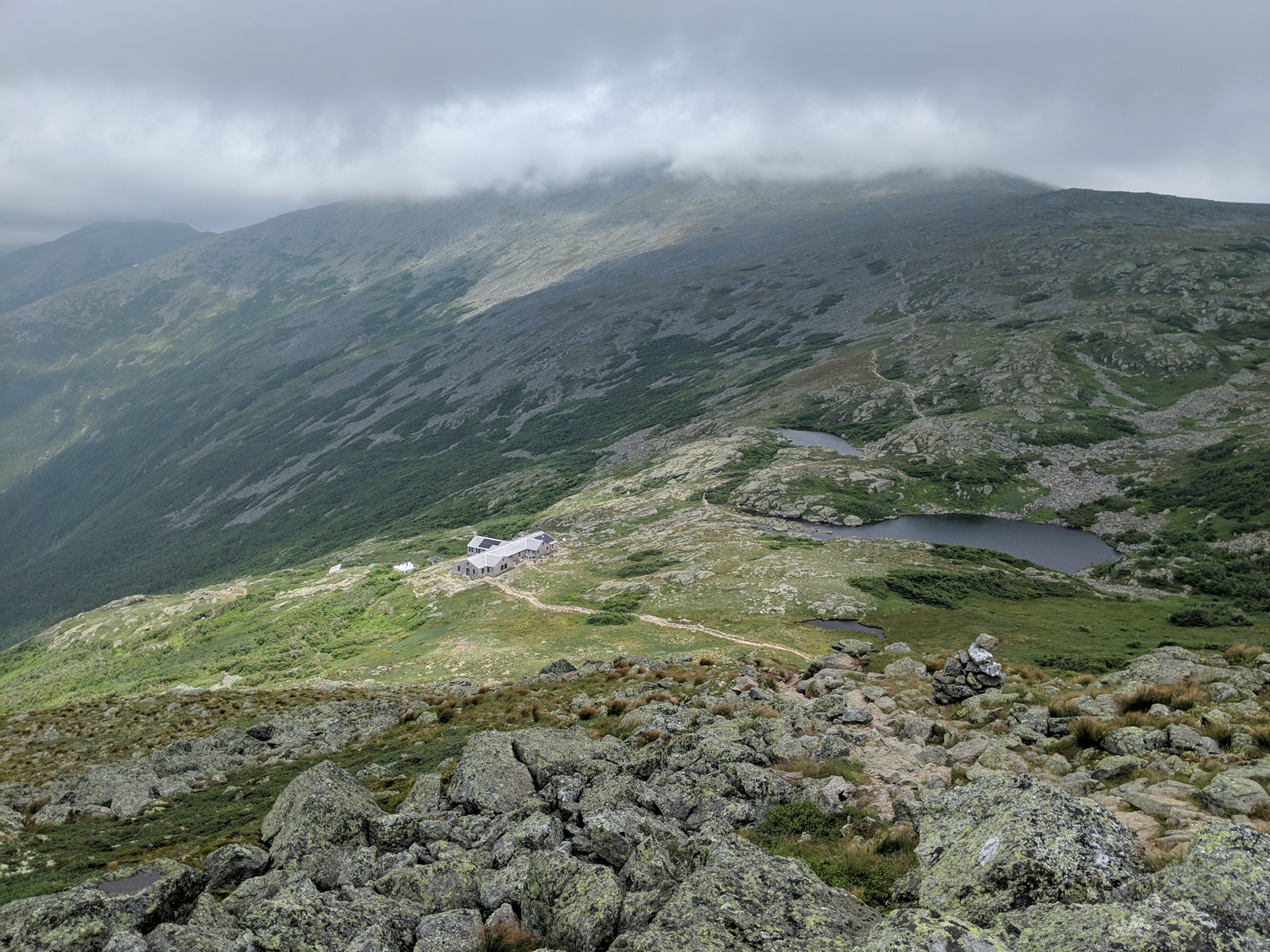
From the summit of Monroe the trail descends very steeply to a flat, open space on the shoulder of Washington, containing the Lakes of the Clouds and another AMC mountain hut. I refilled on water again and sat down outside to rest. I was starting to get tired and was faced with a decision.
The Crawford Path continues up to the summit of Washington, but I had planned for this to be as far as I went along it. I would take the camel trail around to the Davis Path and descend below treeline to find a campsite. But it was only 2:30 in the afternoon, and I was still feeling pretty good. Mount Washington was only 1.4 miles away, 1,200 feet above me.
I had already summitted Washington from the north last year, but it's such a unique place and windows of good weather are so rare that I couldn't resist. I figured if I kept up the pace I had been hiking at I could still make it to my target campsite before sunset. I passed the camel trail junction and continued up the Crawford Path.
By the halfway point I was starting to think this was a mistake. The steep terrain of sharp rocks made me realize how tired and sore I actually was, but I pushed on. Progress was slow and I had to take frequent short breaks. But after more than an hour of tough climbing I reached the top.

The summit of Washington is always a bit of a surreal experience. After hours of pristine mountain trails occupied only by wildlife and other hikers you emerge into a theme park with a gift shop, cafeteria, and hundreds of tourists who took the cog railway or auto road to the top.
I was feeling pretty exhausted by this point, and the whole summit was still in a cloud so there were no real views. I got a picture with the summit sign and sat down inside the cafeteria to rest my legs and eat something out of the wind.
At this point I knew I had to cover 4 miles and 2,600 feet of descent in order to get to a safe campsite below treeline before sunset, so I couldn't stay long. I started back down the Crawford Path, and turned left onto the Davis Path after half a mile. This would be my trail for the rest of the trip.
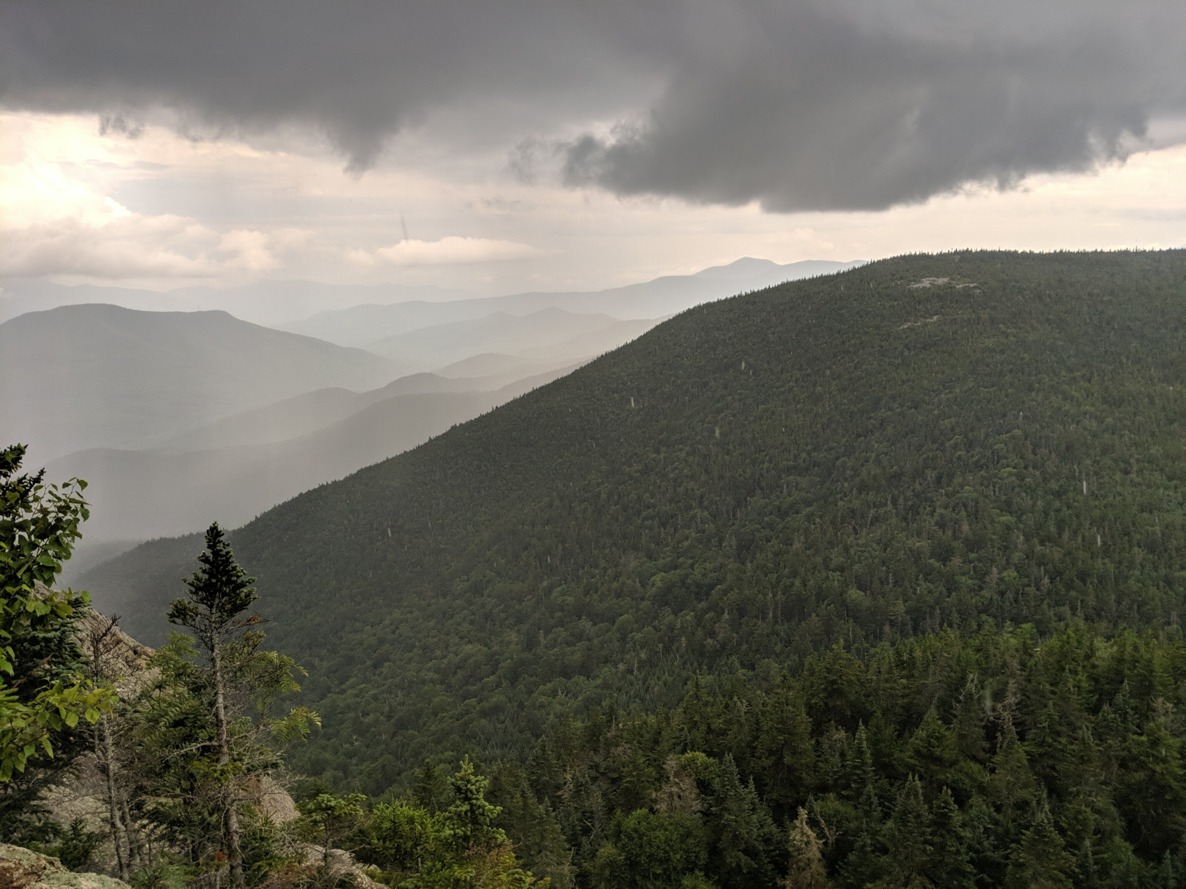
The Davis Path took me around to the southeastern side of Mount Washington and across the Bigelow Lawn, a huge, flat expanse of rocks and waving sedge grass. This high-altitude mountain shoulder is cris-crossed by many trails marked by stone cairns topped with big pieces of quartz, and at this time of day it was completely devoid of people besides me.

The speckled granite boulders, huge chunks of white quartz, and green grass swaying in the breeze made for a breathtaking scene. I wanted to just sit and take it in for a while, but I knew I had to keep moving. I crossed the sea of grass to Boott Spur, a small subpeak of Washington, and started descending rapidly down the Montalban ridge. There were only a few miles to go, but the setting sun, rising wind, and increasing exhaustion made it feel much longer.
I dipped back below the treeline around 7:00, descending through dense pine forest and around the insignificant summit of North Isolation. Finally I reached a designated campsite at the intersection of the Davis Path and Isolation Trail right as the sun was setting. I quickly set up my hammock and hung a bear bag while I could still see without a flashlight. I didn't bring a stove on this trip so I just ate a cold chicken packet and went to bed. It felt good to finally put up my feet in a hammock after 13 miles and 5,500 feet of elevation gain.
Day 2
The next morning I woke up at 7:00 and hiked a quarter mile down the Isolation Trail to find a water source. I knew there wouldn't be much reliable water for the rest of the day so I needed to stock up now. With my water bottles filled I returned to the campsite, ate a breakfast of granola and freeze-dried strawberries, and packed up camp.
The plan for day 2 was to follow the Davis Path all the way back to Crawford Notch, down the road from where I started. Along the way I would bag a few montains off the side of the trail. The first of these was Mount Isolation, a mile from where I made camp and a short, steep climb off the side of the trail. This was my 30th 4,000-footer, and the last one I would get on this trip. The summit provided some nice views of the Presidentials and a good place to stop and have a snack.
The Davis Path passes through the Presidential Range - Dry River Wilderness, and like most wilderness trails it's not always easy to follow. The trail is rough, often filled with deep mud, overgrown by dense vegetation, or blocked by fallen trees. There are no blazes and there's plenty of elevation gain and loss along the ridgeline. My pace was slow, but at least the weather was still good.
The next peak to bag was Mount Davis, 1.1 miles after Isolation. This mountain isn't a 4,000 footer or one of the 52 With a View, but it does afford nice views from a viewpoint after a steep scramble.
Back into the green tunnel of trees I continued up and down through the mud and rocks, 3.7 miles to the next spur trail, Stairs Mountain, one of the 52 With a View. These are a list of NH peaks under 4,000 feet that still have impressive views. At some point it started raining, and it was a real downpour by the time I reached the overlook on Stairs. I sat on the rock ledge and ate a clif bar in the rain.
I still had a long way to go, and the rain was making progress even slower. I had originally intended to grab two more of the 52 WAV on this trip: Mount Crawford and Mount Resolution. But I realized I wouldn't have time if I was going to make it to the trailhead before dark. I'll come back for these two mountains another time.
I continued past the trails to Resolution and Crawford, descending over extremely slippery open rock slabs. I had to move very slowly to not slip and fall on these, and the rain was relentless.
The final two miles of the Davis Path descend 2,000 feet in classic steep, rocky NH terrain. This part actually wasn't so bad, I was mostly protected from the wind and rain by trees and I could just focus on trying to descend without destroying my knees.
Finally I reached the Davis Path trailhead right before sunset and hitched a ride back to where I parked the day before, 8 miles up the road. It ended up being about 11 miles total for the day, with 1,700 feet of elevation gain.
In hindsight, I may have pushed too hard on the first day, and it would probably have been wiser to skip Washington. But it ended up being a great and memorable trip. Hiking in the Presidential Range is such a unique experience, I hope I get to do it a lot more in the future.