Backpacking Mount Isolation in the rain
Last weekend I headed out into one of the most remote parts of the White Mountain National Forest to climb Mount Isolation via some less-used trails. On the two-day trip I experienced pouring rain, difficult trails, a bear encounter, and lots of true isolation.
Day 1
I've hiked Mount Isolation on a previous backpacking trip, so this time I wanted to take a longer and less popular route. I started the trip at Rocky Branch Trailhead South, at the end of Jericho Road in Bartlett NH. When I got to the parking lot at 8:00 on Saturday morning there was only one other car, which foreshadowed the kind of trip I was about to have.
Most of the trip is in the Presidential Range-Dry River Wilderness, which is remote and seldom travelled, despite being in the heart of the White Mountains. Being a wilderness are, trails are very rugged, difficult to follow, and generally unmarked. A perfect way to get away from the crowds on a summer weekend.
A sign at the trailhead warned me about the current state of Rocky Branch Trail. The trail follows an old logging railroad grade that once ran alongside the Rocky Branch of the Saco River, but in recent years high water from various storms (especially Hurricane Irene in 2011) has caused parts of the trail to wash away, and in some places even rerouted the whole river.
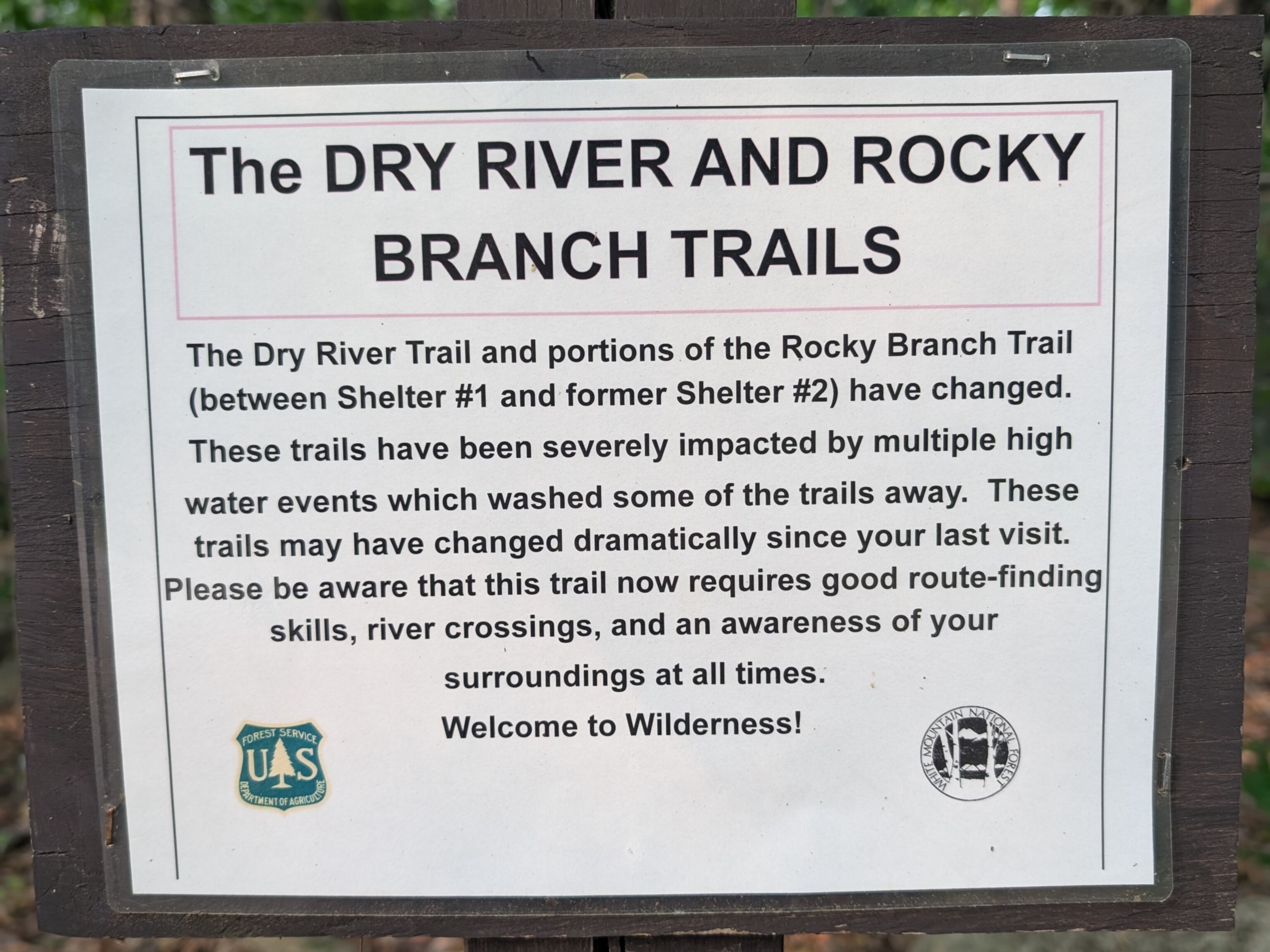
Before even beginning the trail proper there was a 1.8-mile road walk to do. Jericho Road used to continue to a bridge over the Rocky Branch, but that too washed out several years ago. So the Forest Service moved the trailhead 1.8 miles up the road, and the last stretch is now closed to vehicle traffic indefinitely.
The forecast called for rain and possible thunderstorms in the afternoon which would continue into Sunday, but for now the weather was pleasant, and the gravel road walk went by fast. Soon I was at the location of the former bridge.
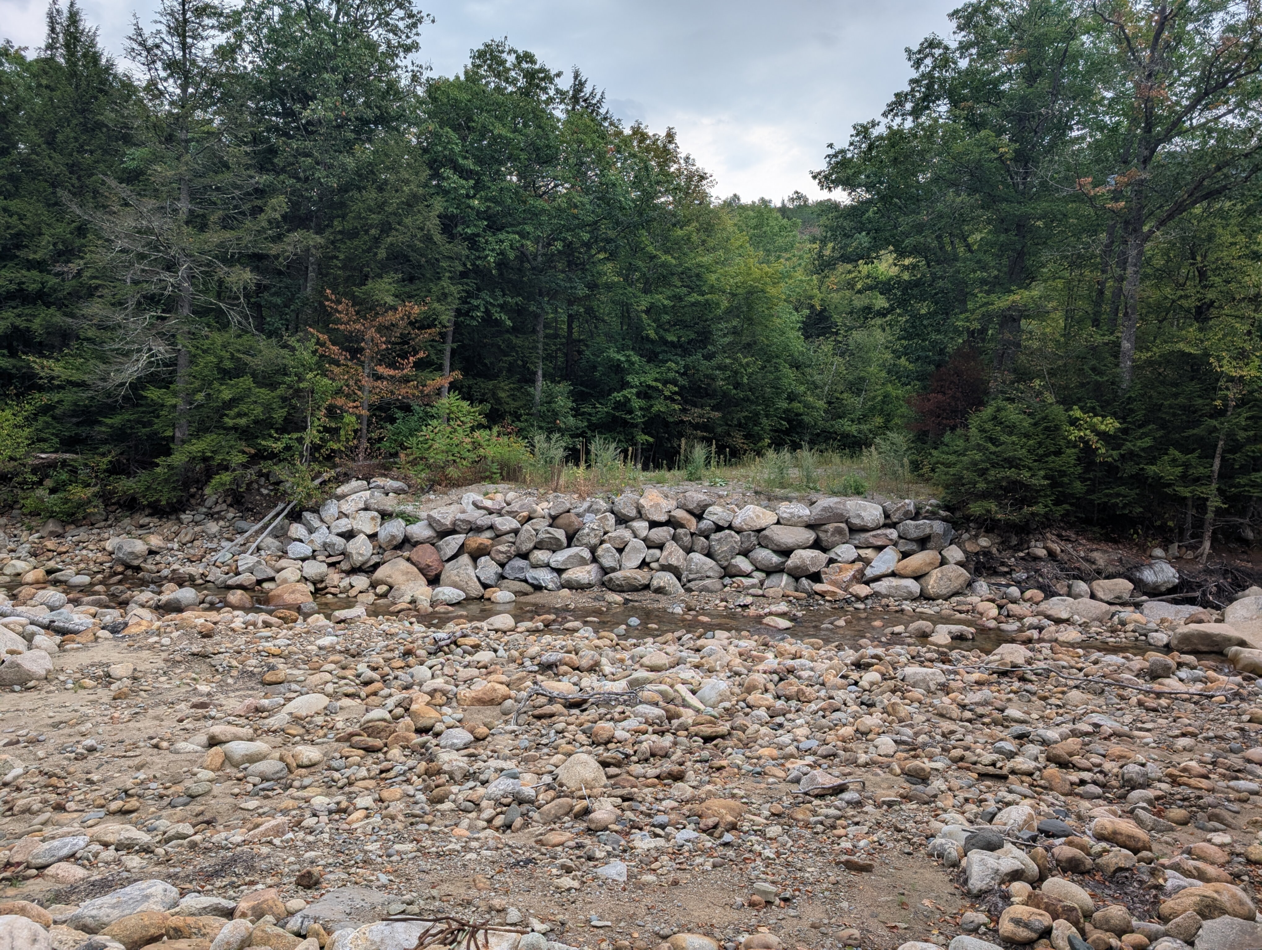
All that remained was the stone foundation on either side of the river. It was easy enough to climb down one side, rock hop across, and scramble up the opposing bank. Now the real trail could begin.
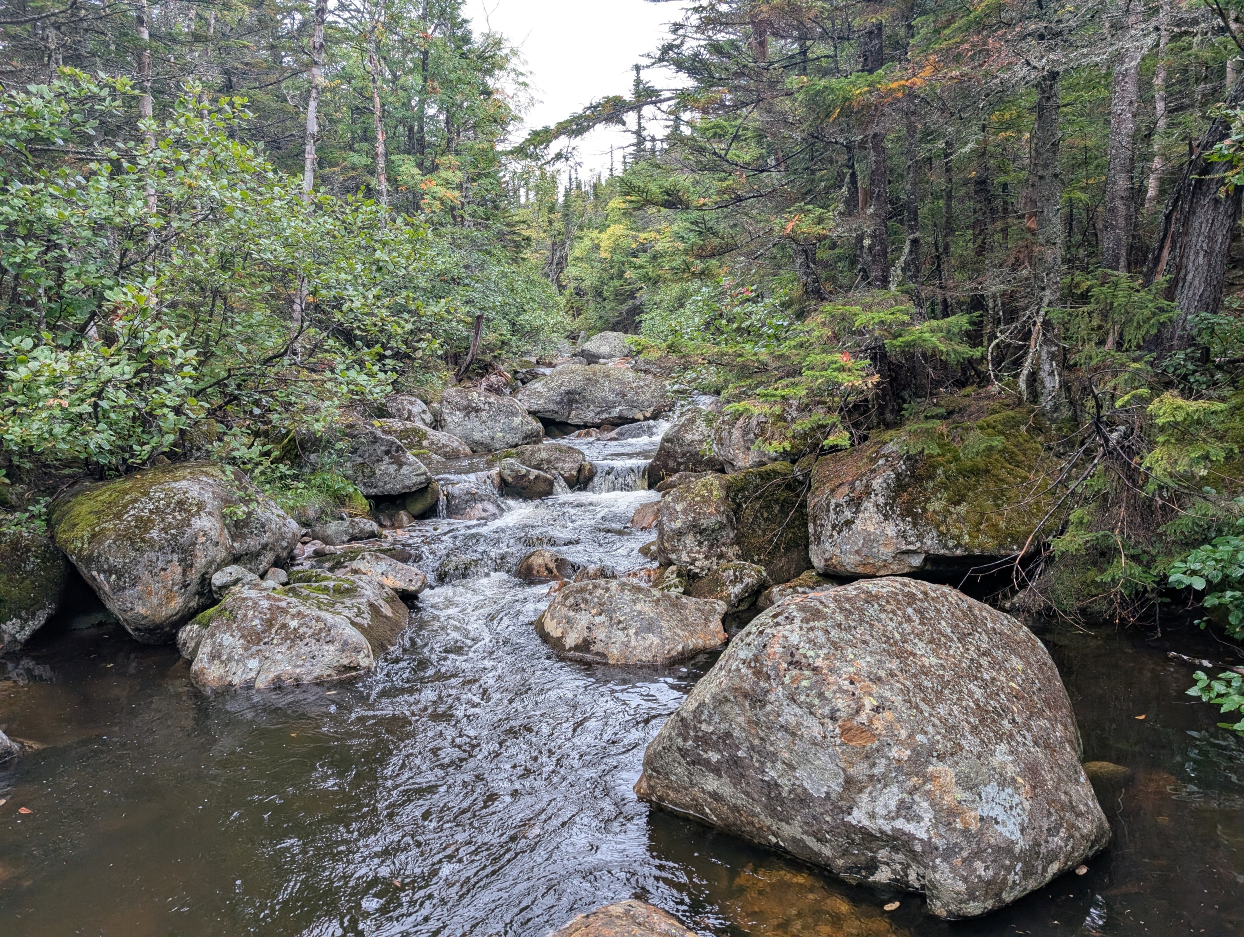
The next two miles were an easy cruise down an old railroad grade. The start of the trail was a good distance from the river, so it was just smooth, straight sailing with a very gentle slope and the occasional small stream crossing. I made it to the next trail junction before I knew it.
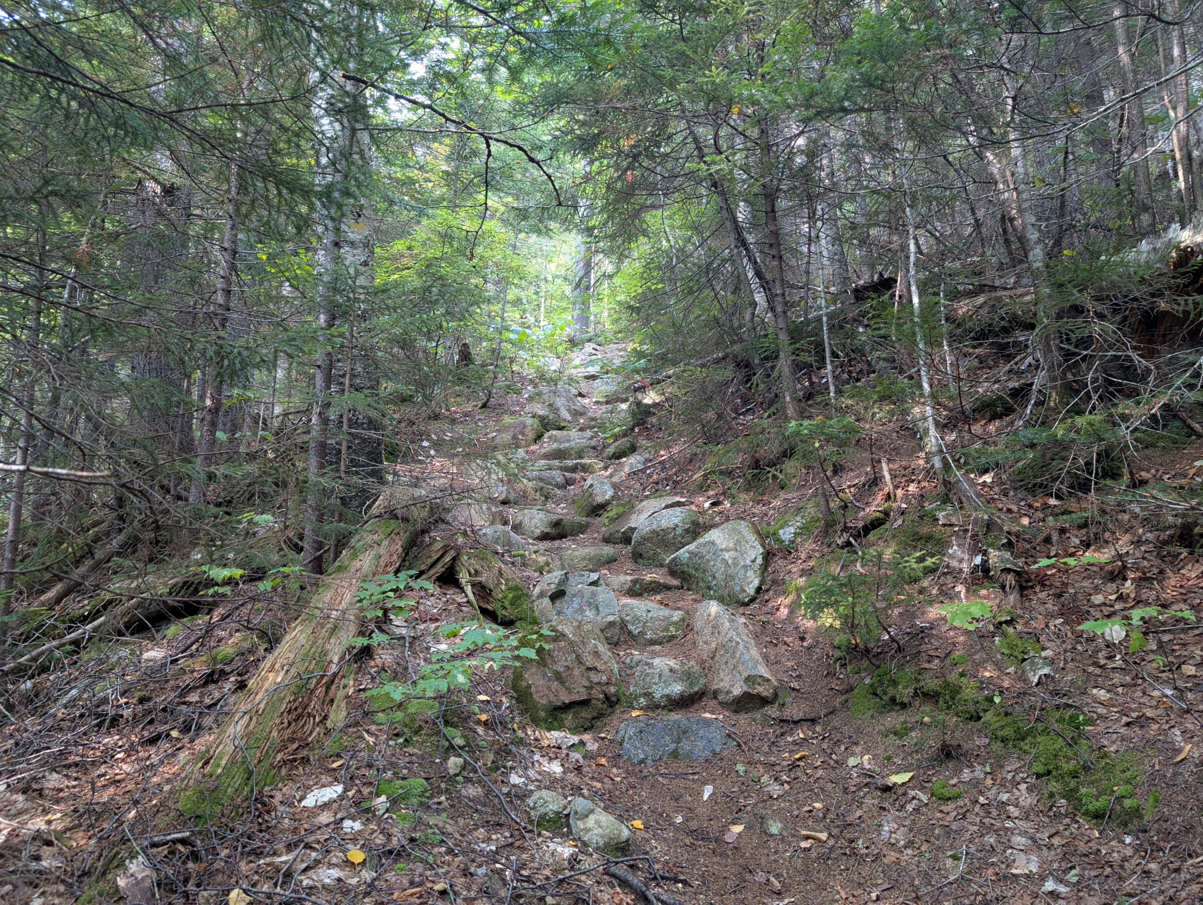
I checked out the shelter by the intersection. It's in surprisingly good shape despite being over 50 years old, and has some nice views overlooking the river. The next leg of my journey would be the biggest continuous climb, 1600 feet up over 1.6 miles to Stairs Col. I knew once I got up to the col I'd be on the ridgeline where water is scarce, so I stocked up and began climbing.
The sun was shining and I was starting to sweat. I stopped for a break and sat down on a log around 10:00, about half a mile up the Stairs Col Trail. As I was eating a protein bar I suddenly realized I could hear footsteps nearby, even though I still hadn't seen any other hikers all day. I looked around, expecting to see a deer or something in the distance.
And there, maybe 30 feet in front of me, was a black bear. It took me a moment to process, I've hiked hundreds of miles in the Whites and never seen a bear until now. It was wandering slowly towards me through the woods, sniffing the ground. It clearly hadn't noticed me. Black bears tend to avoid people, but they can be aggressive if you startle them. I casually called out "hey bear" and it stopped and looked up, directly at me.
The bear paused for a long second, then turned around and ran off into the woods, back down the slope. After I regained my wits I immediately got up and ran the opposite direction up the trail until I was out of breath.
It was a slightly terrifying experience, but I am glad I finally got to see a bear in the wild. I continued up the steep slope and soon made it to the intersection with the Davis Path.
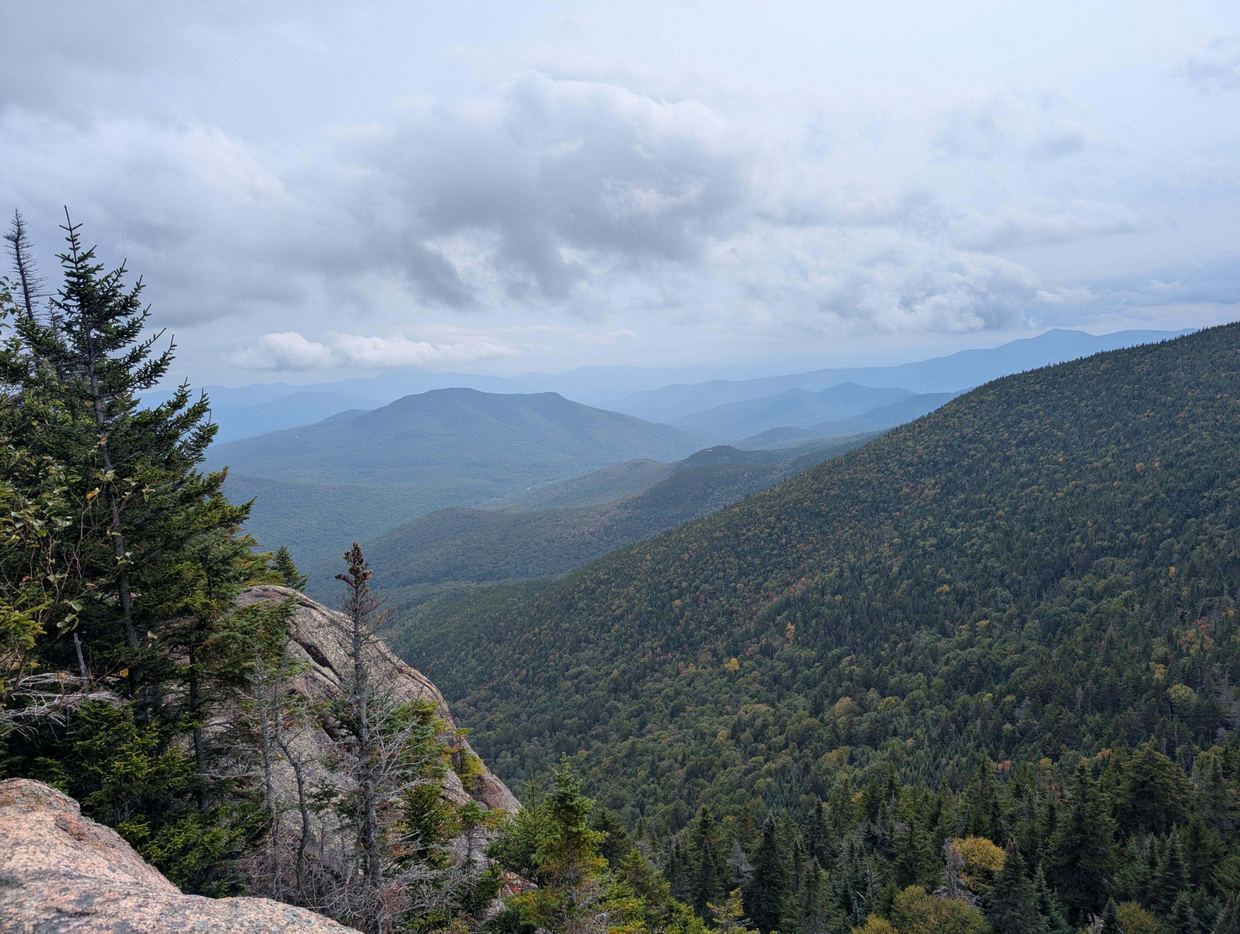
I had hiked the Davis Path before, so from this point I knew mostly what to expect. This is a more popular trail, but still I still hadn't seen any other hikers by the time I made it up to Stairs Mountain, the first viewpoint of the day. I took a break on the open rock ledges and admired the impressive views, along with the approaching rain clouds.
The weather was still fair, but I knew the sky could open up at any moment, so I tried to make as much progress as I could before it started raining. The Davis Path follows Montalban Ridge up and down through some scenic woods until it reaches Mount Isolation, almost 5 miles north of Stairs, then it continues up the ridge all the way to Mount Washington. On my previous trip I had descended the Path from Washington, but this time I was turning off it right after Isolation.
Around 2:00 PM it finally started pouring rain. I put on my jacket and continued up the trail, only about a mile to go until Isolation. When it's so warm out, rain isn't such a big deal. You're going to end up soaked either way, whether it's from rain or sweat.
Eventually I reached the spur for Isolation's summit, over 10 miles from where I had started that morning. I scrambled up the last few rocky feet to the open summit, where I was greeted by incredible views of the Presidential range shrouded in clouds. I didn't stay long or take any pictures, because the rain was blowing sideways and I didn't want to get hit by lightning on the exposed rock summit.
I touched the summit cairn and immediately headed back down. Now I just had to get somewhere to camp for the night. I continued .8 miles up the trail to the intersection with Isolation Trail East and a campsite I had stayed at before. This was one option for camping, but I still had plenty of daylight and I wanted to camp closer to a water source, so I continued down to the East.
It was still pouring rain, and hiking the trail was more like wading through a stream at this point. But it was all downhill, easy to follow, and not too steep, so I made fast progress. Around 5:00 the rain started to let up. I took the opportunity to eat dinner on the trail. After that bear encounter I wanted to be especially careful about not getting food smells near where I was camping. I had a delicious meal of instant ramen with cold water and buffalo-chicken flavored tuna, then quickly covered the last mile to the intersection with Rocky Branch Trail.
There was another designated USFS wilderness campsite by the intersection, I had already hiked 14 miles, and it was nearly sunset, so I decided to stop for the day. Fortunately the rain had fully stopped, so I set up my hammock and got ready for bed. I was extra careful about hanging my bear bag far away from where I was sleeping, just in case.
I fell asleep as the rain started drizzling again, having seen one bear and zero people all day.
Day 2
There was still some light rain in the morning, so I packed up under my tarp. Fortunately nothing had gotten to my bear bag at night, and I felt well-rested and ready to go.
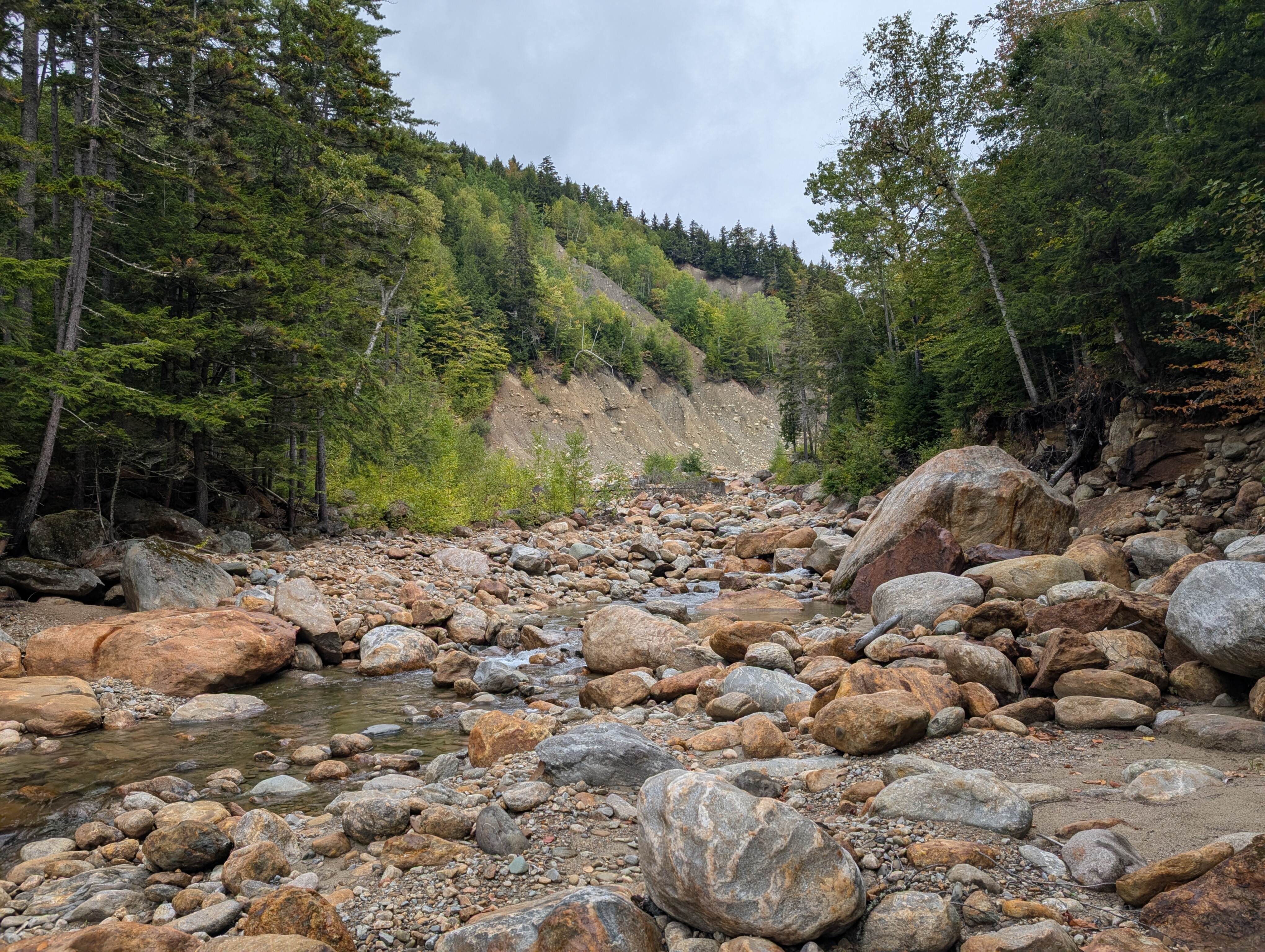
The rest of my schedule was all downhill, following the Rocky Branch Trail back to the trailhead. But as that sign warned, following the trail was not so easy. Here the railroad grade closely hugged the river, and there were lots of spots where it had been washed out completely. The trail would just end at a big cliff, and you had to figure out whether you were supposed to bushwhack up and around the landslide, or climb down to the river and wade downstream until you could regain the trail.
Maps were basically useless here as they just showed the old course of the river and the trail as it used to be, not accounting for all the reroutes that are now necessary. It took some guesswork to follow some of the detours, and I'm pretty sure I ended up off the official trail more than once. Each time I'd eventually find the railroad grade further downstream.
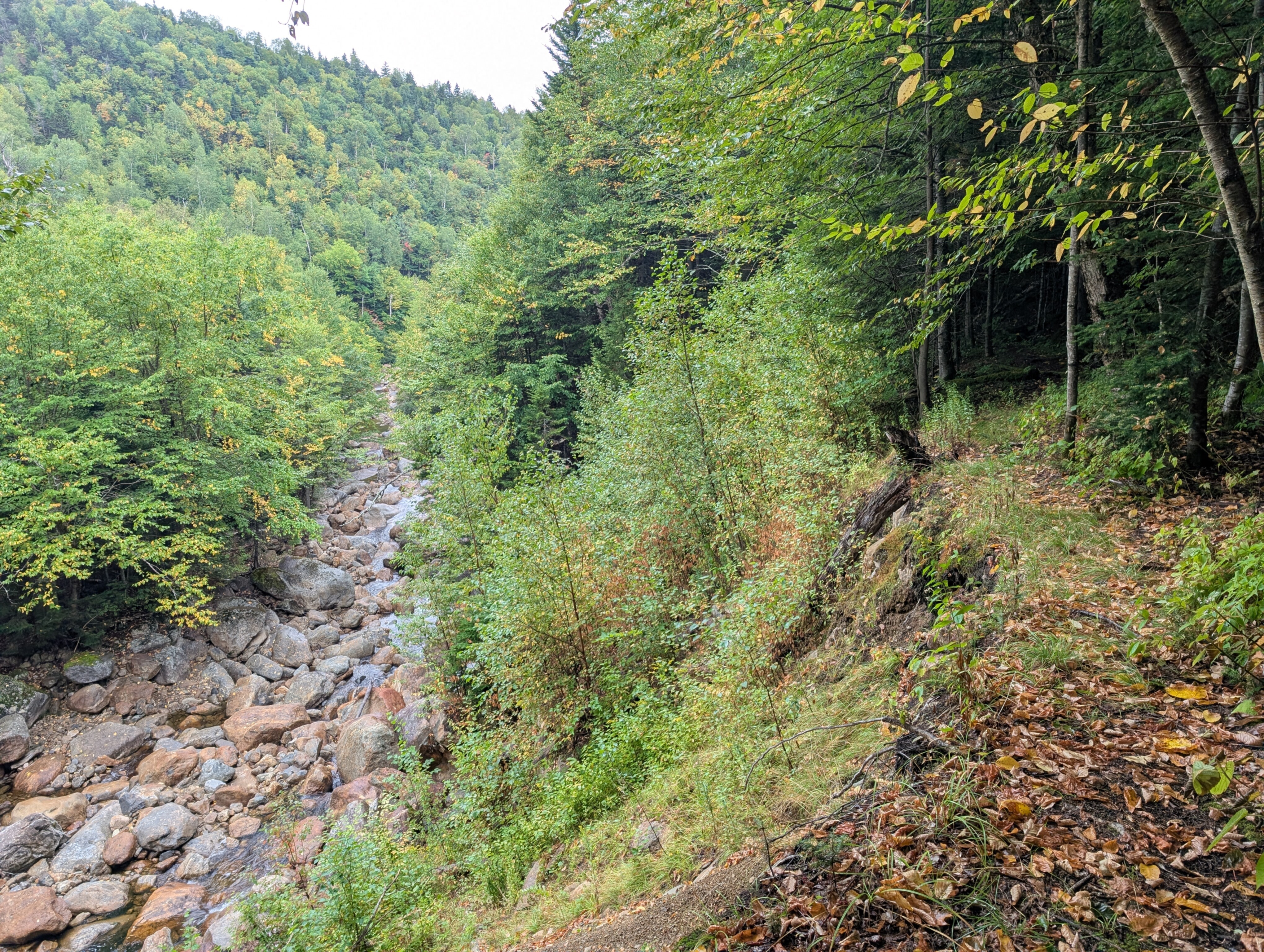
This section was challenging, but also really cool. It was amazing to see the dramatic changes to the landscape caused by the river. The huge land slides, sometimes hundreds of feet high, and vast boulder-strewn course of the river were very different from the type of scenery I'm used to hiking in. The trail even went through a section that used to be an oxbow, but the river cut a new path straight through it, leaving behind a U-shaped path of dry boulders.
The rain eventually stopped, and the sun came out. Some of the leaves on the trees had already started to change colors and fall, especially at higher elevations, which resulted in a very pleasant hike despite how difficult it was to follow the trail.
After several bushwhacks and rock hops I made it back to the junction with Stairs Col Trail, where I had turned off the Rocky Branch Trail the day before. Then it was just 3.8 miles of smooth sailing over trail I knew back to the car.
It was truly a unique trip, and one I won't ever forget. Over a whole summer weekend I didn't see a single other person, encountered a bear, and navigated some tricky weather and trail conditions. It was difficult at times, but that's the fun of hiking.
Total distance: 22 miles, 3500 feet of elevation gain.